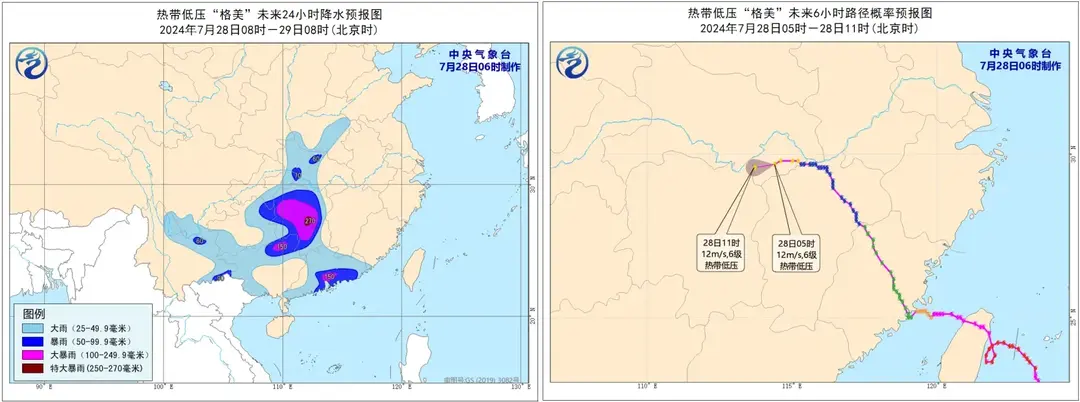
Recently, Typhoon Gaemi has caused severe impacts in Hunan Province. Although the typhoon’s center did not pass through Hunan, the heavy rainfall brought by the typhoon poured down heavily in the region.
Main Disaster Issues Caused by Typhoon Gaemi
- In Yuelin Village, Shouyue Township, Nanyue District, Hengyang City, a landslide triggered by mountain floods destroyed a residential house, trapping 21 people. After intense rescue efforts, all 21 people were found, with 15 unfortunately losing their lives and 6 injured.
- In Zixing City, Chenzhou, 118,000 people were affected, with 1,345 road collapses, widespread communication and power outages, and preliminary reports indicating 30 deaths and 35 missing.
- In Guojiaqiao Xintang Village, Yisuhe Town, Xiangtan County, Xiangtan City, a dike breach occurred.
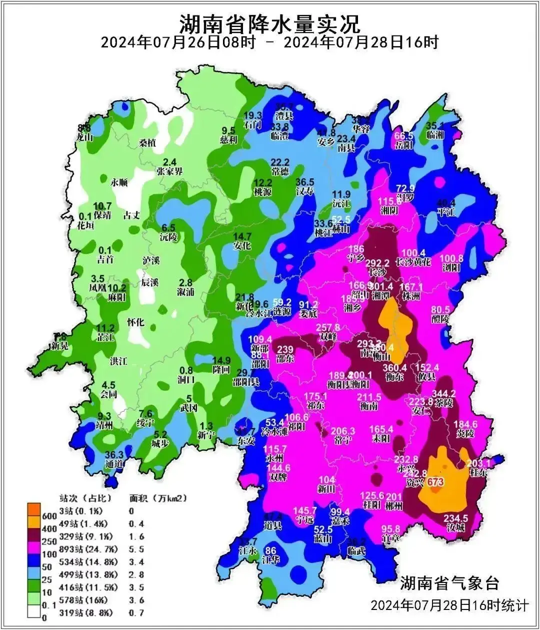
Chenzhou, Hengyang, and Xiangtan were the main areas affected by the typhoon’s rainfall, which is why the three disasters mentioned above were the most severe. Other cities also experienced urban flooding, localized mudslides and landslides, submerged farmland and houses, road blockages, and damage to communication and power systems. For example, my hometown in Shuangfeng County experienced the most severe urban flooding in nearly a century. (In the map above, Shuangfeng is another area with concentrated rainfall, apart from the two rainfall belts in Chenzhou and Hengyang-Xiangtan.)
Landslides
Among the impacts brought by the typhoon, the most severe issue is landslides. The casualties in Hengyang and Chenzhou were all caused by landslides.
The landslide incident in Zixing, in particular, was shocking and vividly demonstrated the insignificance of humans in the face of nature.
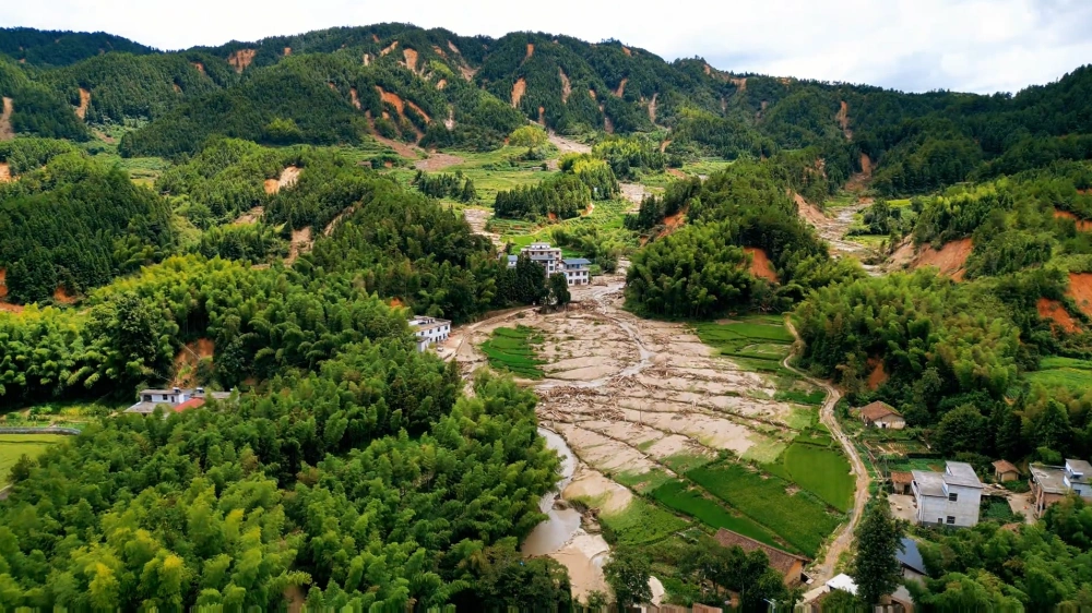
Additionally, the landslide in Zixing, Chenzhou, has reshaped my understanding of landslides and prompted me to reconsider an important concept: hills.
Hills
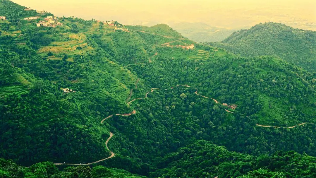
In middle school geography textbooks, it is mentioned that most of Hunan is a hilly region. However, it wasn’t until 2006 when I first saw Google satellite maps that I truly understood what hills were. Before that, I had no concept of hills, feeling that my hometown was purely mountainous. What exactly were hills? I had no idea.
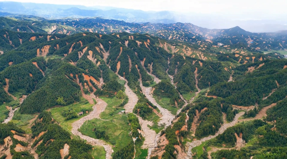
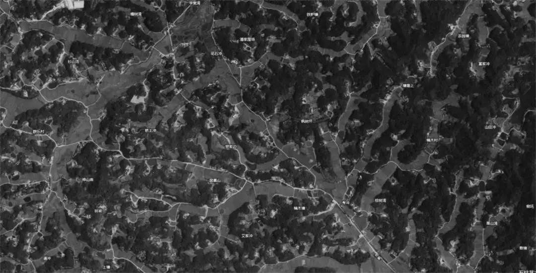
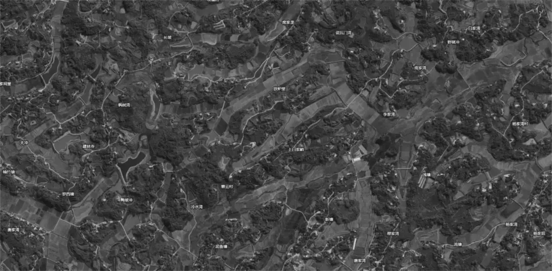
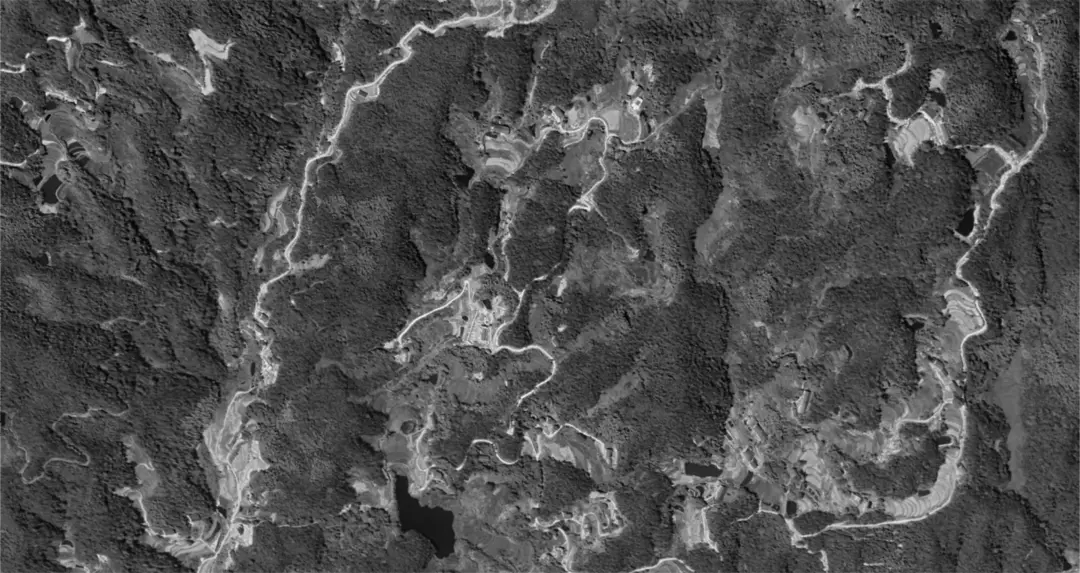
Based on personal experience, I believe the hills in Hunan can be categorized into several types. As shown in the image below, taking the area around Xiangxiang as an example:
- Old Hills: In the middle of the image, the area around the Lianshui River shows almost no trace of hills, with only sporadic small mounds under 10 meters high reminding us that this was once a hilly region.
- Middle-aged Hills: On the left side of the image, these are highly mature hills with relative height differences of about 20-30 meters. If urban development is needed, these small hills can be leveled at any time.
- Young Hills: On the right side of the image, these are hills sheltered by mountains, with relative height differences mostly above 50-100 meters. To the naked eye, it looks like a mountainous area, and living here feels no different from living in the mountains.
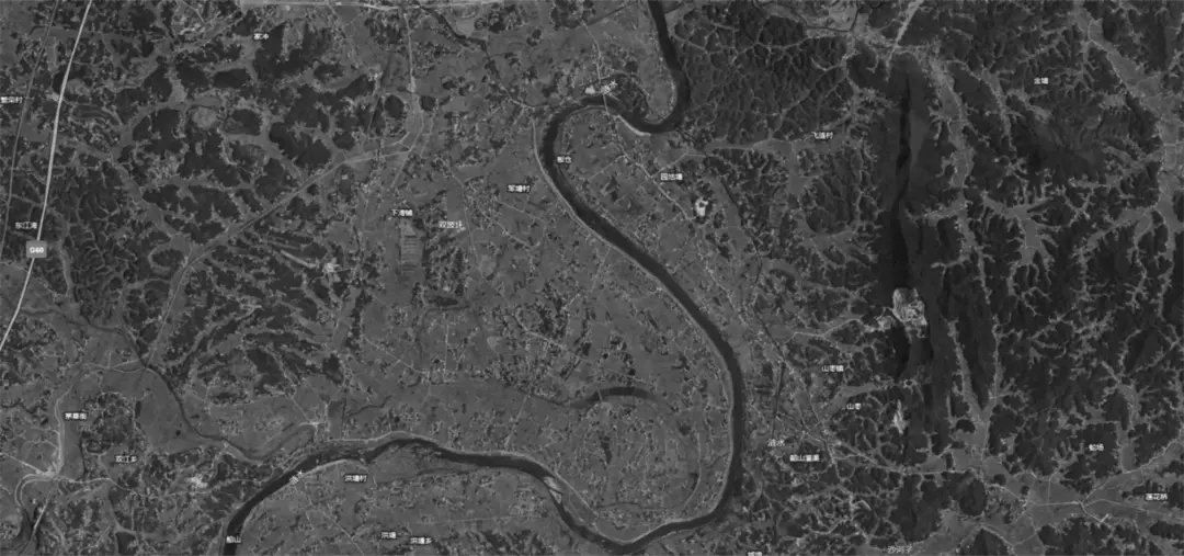
Old Hills
After millions of years of erosion by rainwater, these hills have almost turned into plains.
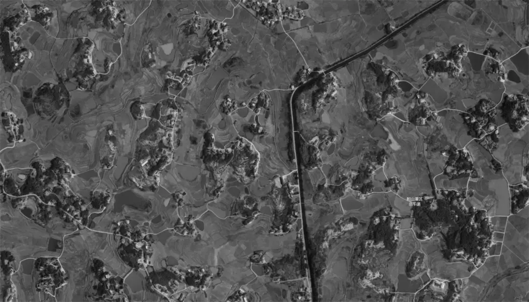
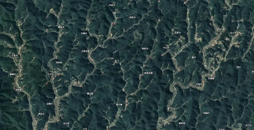
Middle-aged Hills
Hills are widespread, with most retaining some mountain features. Everywhere you look, there are small hills.
Young Hills
Without looking at satellite maps, these areas are indistinguishable from mountainous regions. Everywhere you look, there are mountains.
Conclusion
There is no doubt that hills are primarily formed by rainwater erosion. In Hunan, which has the most stable tectonic plate in the country and has hardly experienced earthquakes, the only force capable of rapidly reshaping the landscape is rainwater.
Mountains erode into small hills, small hills erode into mounds, and mounds erode into flat land. This process involves endless landslides.
It just so happens that the large-scale landslide in Chenzhou was captured on camera. However, such scenes have actually been a constant throughout the billions of years of Earth’s history.
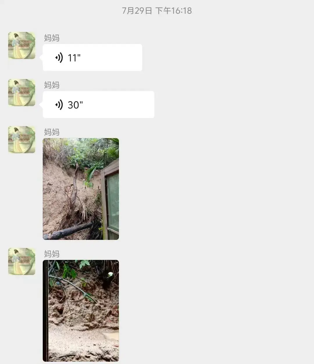
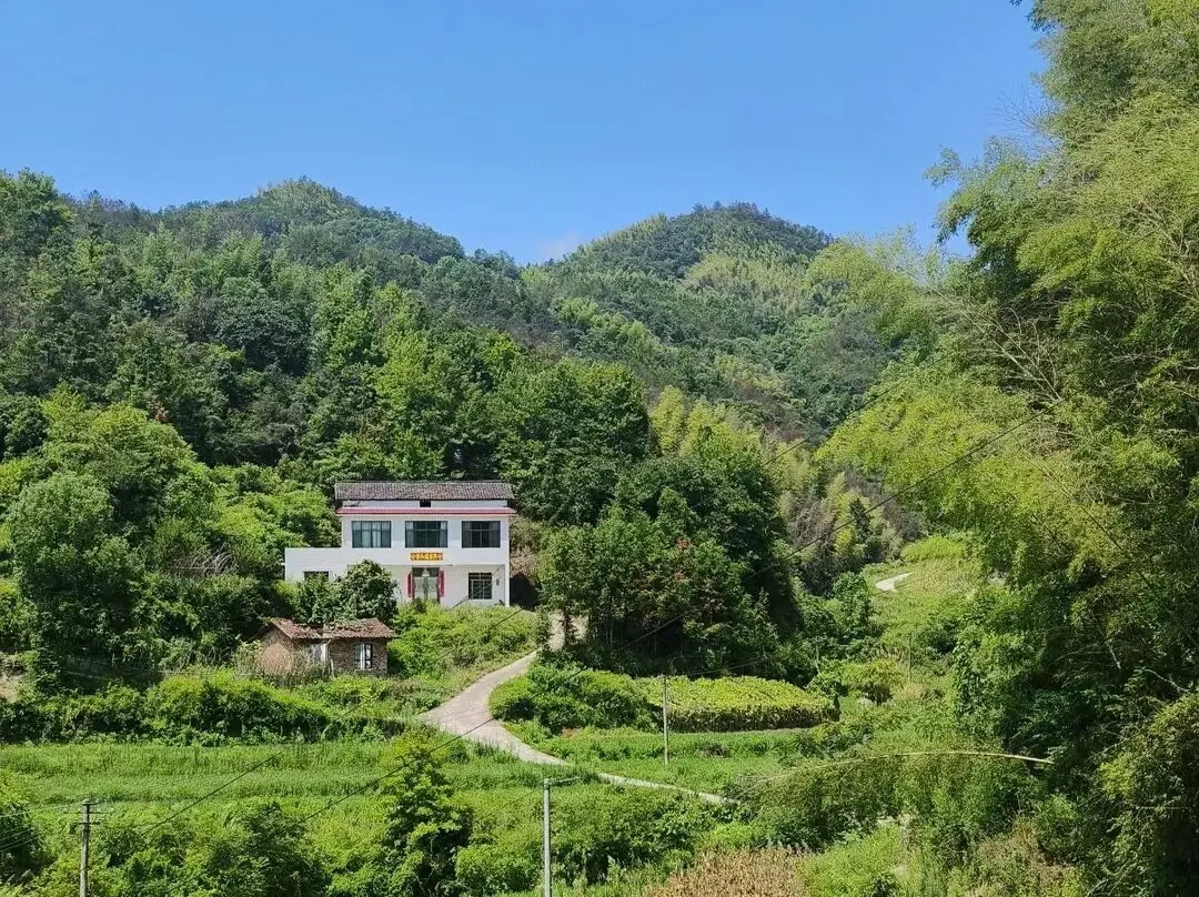
Additionally, my hometown also experienced a landslide behind our house. Several terraced vegetable plots at the back, which had been neglected for years, accumulated rainwater, causing the soil at the edges to erode and block the drainage ditch.